Պատկեր:Kakheti in Georgia (Georgian view).svg

Size of this PNG preview of this SVG file: 800 × 426 պիքսել. Այլ թույլտվությաններ: 320 × 170 պիքսել | 640 × 341 պիքսել | 1024 × 545 պիքսել | 1280 × 681 պիքսել | 2560 × 1363 պիքսել | 1715 × 913 պիքսել.
Սկզբնական նիշք (SVG-նիշք, անվանապես 1715 × 913 փիքսել, նիշքի չափը՝ 552 ԿԲ)
Նիշքի պատմություն
Մատնահարեք օրվան/ժամին՝ նիշքի այդ պահին տեսքը դիտելու համար։
| Օր/Ժամ | Մանրապատկեր | Օբյեկտի չափը | Մասնակից | Մեկնաբանություն | |
|---|---|---|---|---|---|
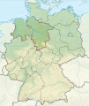
| ընթացիկ | 11:18, 12 հոկտեմբերի 2020 |  | 1715 × 913 (552 ԿԲ) | TUBS | Reverted to version as of 07:05, 7 October 2020 (UTC) We have discussed that (cf. my user talk page): I don't have enough evidence that your map is correct (maybe it is though). Don't start an edit war: Please reupload your maps with a different name and try to exchange my maps with your maps in the respective WP articles. That's better anyway so that editors in their respective WP don't fell bypassed. |
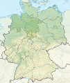
| 17:48, 11 հոկտեմբերի 2020 |  | 1715 × 913 (373 ԿԲ) | გიო ოქრო | Reverted to version as of 20:35, 6 October 2020 (UTC) | |
| 07:05, 7 հոկտեմբերի 2020 |  | 1715 × 913 (552 ԿԲ) | TUBS | that's the georgian view. Georgia certainly doesn't acknowledge the borders of split-off rgegions, does it? | |
| 20:35, 6 հոկտեմբերի 2020 |  | 1715 × 913 (373 ԿԲ) | გიო ოქრო | borders changed | |
| 10:32, 7 օգոստոսի 2011 |  | 1715 × 913 (552 ԿԲ) | TUBS |
Նիշքի օգտագործում
Հետևյալ 2 էջերը հղվում են այս նիշքին՝
Նիշքի համընդհանուր օգտագործում
Հետևյալ այլ վիքիները օգտագործում են այս նիշքը՝
- Օգտագործումը av.wiki.x.io կայքում
- Օգտագործումը bg.wiki.x.io կայքում
- Օգտագործումը ceb.wiki.x.io կայքում
- Օգտագործումը de.wiki.x.io կայքում
- Օգտագործումը de.wikivoyage.org կայքում
- Օգտագործումը en.wiki.x.io կայքում
- Օգտագործումը et.wiki.x.io կայքում
- Օգտագործումը eu.wiki.x.io կայքում
- Օգտագործումը fa.wiki.x.io կայքում
- Օգտագործումը frr.wiki.x.io կայքում
- Օգտագործումը he.wiki.x.io կայքում
- Օգտագործումը hr.wiki.x.io կայքում
- Օգտագործումը id.wiki.x.io կայքում
- Օգտագործումը incubator.wikimedia.org կայքում
- Օգտագործումը ja.wiki.x.io կայքում
- Օգտագործումը lt.wiki.x.io կայքում
- Օգտագործումը lv.wiki.x.io կայքում
- Օգտագործումը ml.wiki.x.io կայքում
- Օգտագործումը nn.wiki.x.io կայքում
- Օգտագործումը no.wiki.x.io կայքում
- Օգտագործումը pt.wiki.x.io կայքում
- Օգտագործումը sco.wiki.x.io կայքում
- Օգտագործումը simple.wiki.x.io կայքում
- Օգտագործումը sl.wiki.x.io կայքում
- Օգտագործումը sr.wiki.x.io կայքում
- Օգտագործումը ur.wiki.x.io կայքում


